XBP Radar
X-Band Polarimetric Radar Information System
X-Band Polarimetric Radar Information System
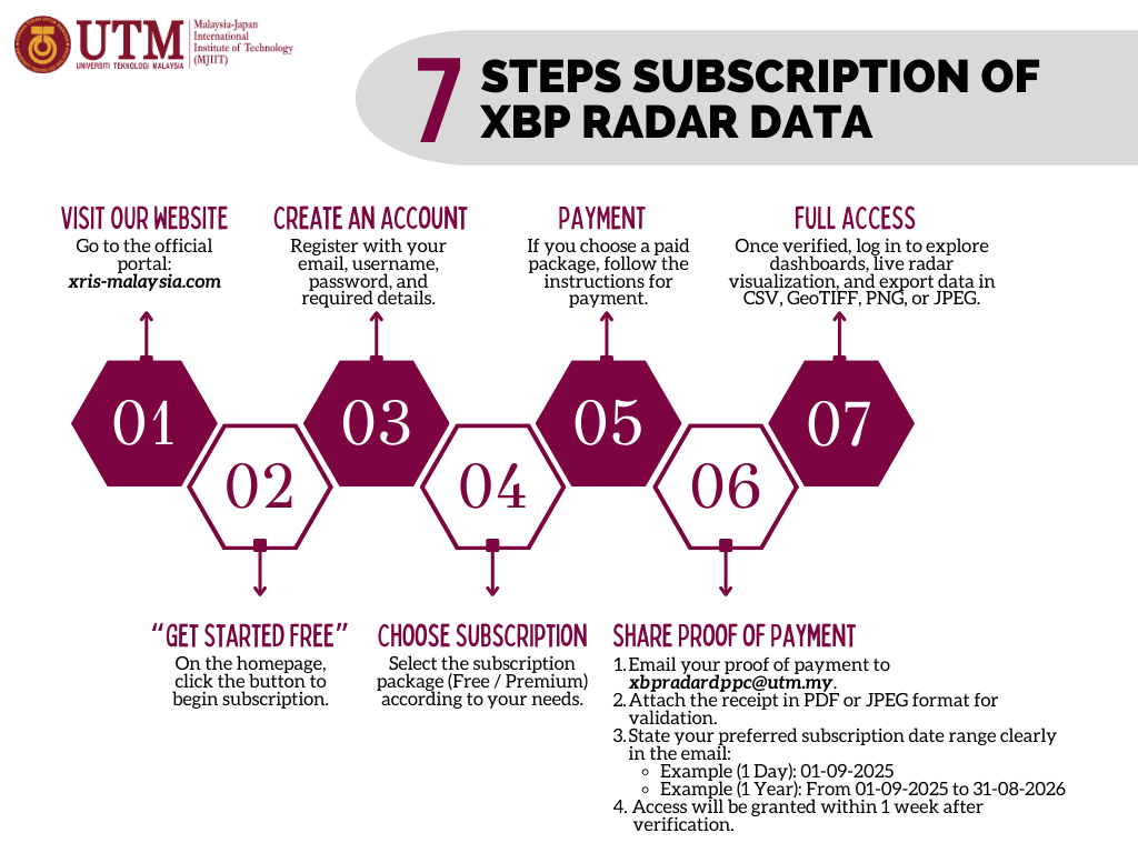
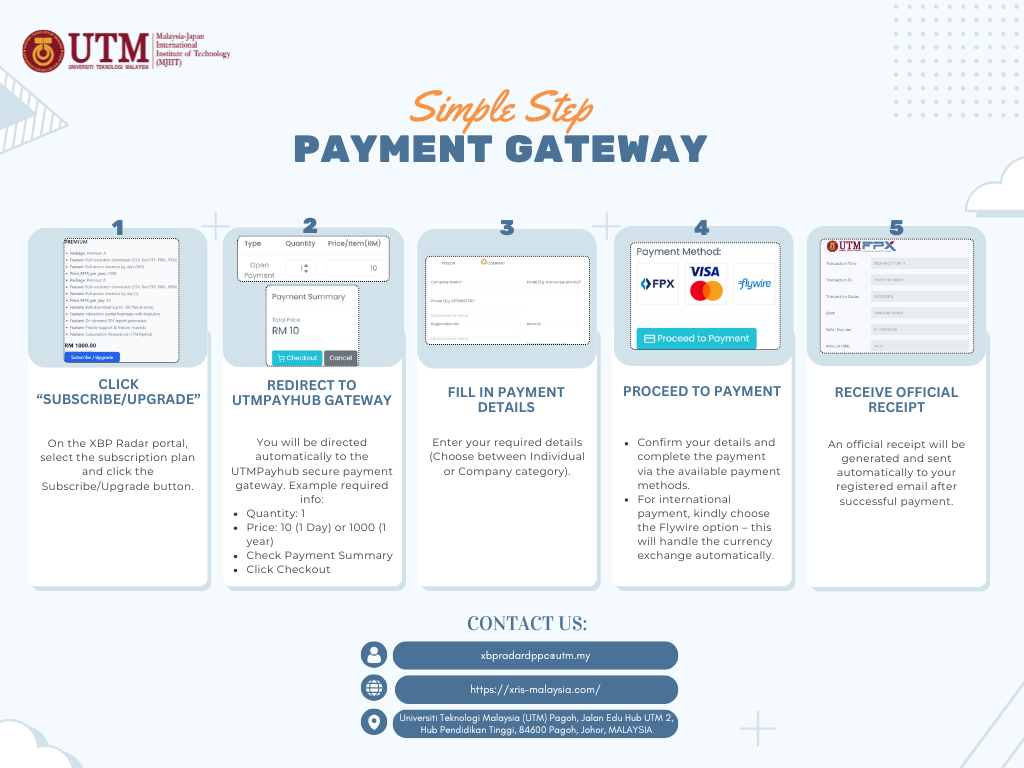
XBP Radar Information System is a web-based platform to access, analyze, and visualize data...
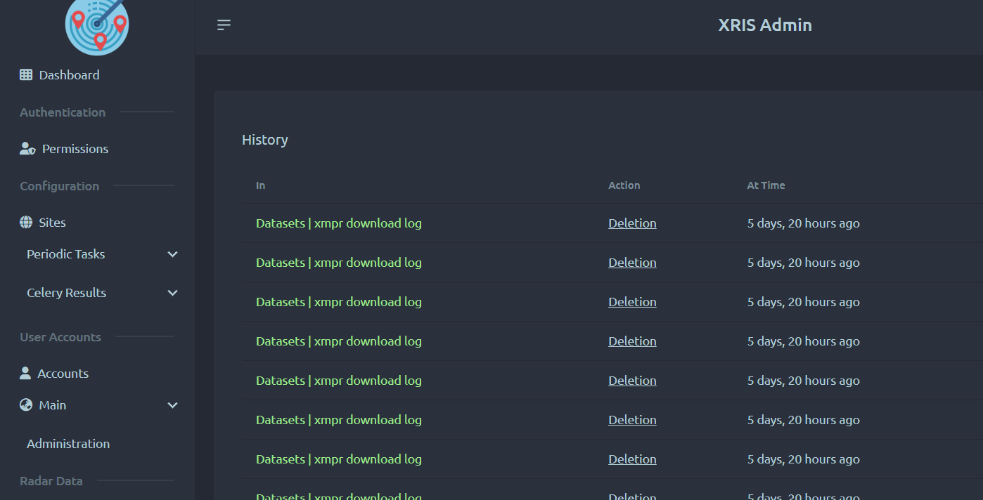
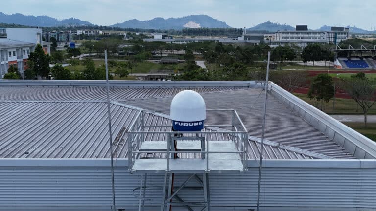
XBP Radar Information System is a Django-based platform developed at MJIIT, Universiti Teknologi Malaysia. It ingests, processes, stores, and serves XBP Radar datasets (CSV, GeoTIFF, PNG, JPEG) with a focus on: Data Management & Analysis: Powerful tools for researchers and meteorologists to explore and analyze rainfall data. Real-Time Live Radar Visualization: Interactive map overlays of radar imagery. User-Friendly Dashboards: Intuitive interfaces, subscription tiers, secure authentication, and reporting.
Data Management & Analysis: Powerful tools for researchers and meteorologists to explore and analyze rainfall data. Real-Time Live Radar Visualization: Interactive map overlays of radar imagery. User-Friendly Dashboards: Intuitive interfaces, subscription tiers, secure authentication, and reporting.